


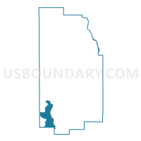
WILSON Voting District, Teton County, Wyoming
About
Outline

Summary
| Unique Area Identifier | 698913 |
| Name | WILSON Voting District |
| County | Teton County |
| State | Wyoming |
| Area (square miles) | 112.01 |
| Land Area (square miles) | 111.97 |
| Water Area (square miles) | 0.04 |
| % of Land Area | 99.97 |
| % of Water Area | 0.03 |
| Latitude of the Internal Point | 43.45615220 |
| Longtitude of the Internal Point | -110.97438390 |
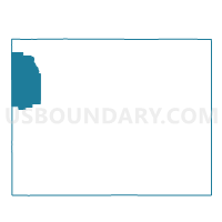
Maps

Graphs
Select a template below for downloading or customizing gragh for WILSON Voting District, Teton County, Wyoming


Neighbors
Neighoring Voting District (by Name) Neighboring Voting District on the Map
- ALPINE Voting District, Lincoln County, WY
- ALTA SCHOOL NORTH Voting District, Teton County, WY
- JACKSON HOLE AIRPORT Voting District, Teton County, WY
- TETON PINES Voting District, Teton County, WY
- Wilson School Voting District, Teton County, WY
- WyDOT Voting District, Teton County, WY
Top 10 Neighboring County Subdivision (by Population) Neighboring County Subdivision on the Map
- Jackson Hole CCD, Teton County, WY (20,669)
- Afton CCD, Lincoln County, WY (12,578)
- Alta CCD, Teton County, WY (544)
Top 10 Neighboring Place (by Population) Neighboring Place on the Map
- Moose Wilson Road CDP, WY (1,821)
- Wilson CDP, WY (1,482)
- Hoback CDP, WY (1,176)
- Teton Village CDP, WY (330)
Top 10 Neighboring Unified School District (by Population) Neighboring Unified School District on the Map
Top 10 Neighboring State Legislative District Lower Chamber (by Population) Neighboring State Legislative District Lower Chamber on the Map
- State House District 22, WY (12,218)
- State House District 16, WY (10,206)
- State House District 23, WY (9,763)
Top 10 Neighboring State Legislative District Upper Chamber (by Population) Neighboring State Legislative District Upper Chamber on the Map
Top 10 Neighboring 111th Congressional District (by Population) Neighboring 111th Congressional District on the Map
Top 10 Neighboring Census Tract (by Population) Neighboring Census Tract on the Map
- Census Tract 9780, Lincoln County, WY (6,801)
- Census Tract 9677.02, Teton County, WY (6,411)
- Census Tract 9676, Teton County, WY (4,600)
Top 10 Neighboring 5-Digit ZIP Code Tabulation Area (by Population) Neighboring 5-Digit ZIP Code Tabulation Area on the Map
- 83001, WY (15,851)
- 83014, WY (3,595)
- 83128, WY (1,601)
- 83414, WY (544)
- 83025, WY (400)
- 83012, WY (180)